Top of Page (AccessKey T)

Demolition Phase Four

Thumbnail of Phase 4 map showing approximately 200 acres, highlighting the LOX Area in NASA Area 1 and the Bravo Test Stand 3 area in NASA Area 2.

Map of Phase 4 demolition

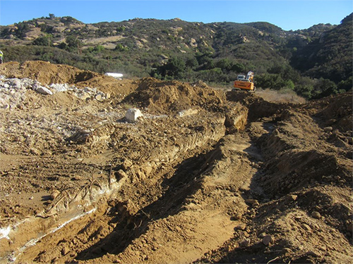
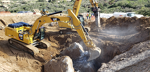
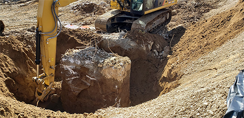
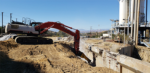
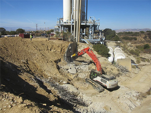
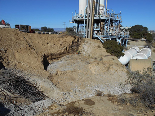
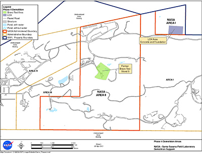
Phase 4 demolition focuses on the removal of a subsurface concrete slab that remains in Area I LOX, as well as the retaining wall, concrete foundation, and spillway of the former Bravo Test Stand 3.

Locations

Demolition Phase Updates

Phase 4 Demolition Progress

Published 5/19/2021

The photos below show the concrete removal at LOX in October 2018 as part of the Phase 4 demolition.

An excavator is shown at the end of a large trench that has been dug several feet into the earth. On the left side of the trench, a large concrete slab is exposed. This is the concrete slab that is being demolished in Phase 4.
In this photo an excavator is shown digging into a large area several feet into the earth. Much of the concrete slab has been removed but chunks of concrete can be seen on the ground, as well as rebar.
In this photo an excavator is lifting a large block of concrete slab out of the ground.
In this photo, the concrete has been removed and the ground has been filled in and smoothed. A worker is shown spraying green hydroseed mix over the surface of the ground to promote revegetation.
An excavator with a special hammer attachment is shown breaking up the concrete retaining wall of the former Bravo Test Stand 3.
An excavator with a special hammer attachment is shown breaking up the remaining concrete retaining wall of the former Bravo Test Stand 3.
In this photo the large retaining wall has been completely removed. Small chunks of concrete remain on the ground as well as rebar, which sits in a pile off to the side. The main Bravo Test Stand is shown in the background.